Park offers hiking and a glimpse of the area’s past.
LAVERKIN — For generations, the scenic confluence of LaVerkin Creek, Ash Creek and the Virgin River has provided a place for Hurricane Valley residents to recreate and enjoy nature.
And thanks to the ongoing efforts of a number of area entities, the area should continue to offer a scenic respite for years to come.
Several hundred visitors came together Monday to celebrate the work being done at Confluence Park, a 344-acre wilderness area tucked between Hurricane, LaVerkin and Toquerville.
Utilized for centuries by the Virgin Anasazi of Southwestern Utah, the Southern Paiutes and later by settlers of The Church of Jesus Christ of Latterday Saints, the countyowned park now includes a number of modern amenities, such as a new parking
area and restrooms at the LaVerkin Creek Trailhead, where area officials hosted a ribbon cutting and other festivities on Monday.
But the wilderness of the park, located at the foot of basaltic cliffs about 200 feet below the surrounding communities, remains intact, which helps preserve an essential part of the area’s history and heritage, said Jeanette Staheli Benson, who grew up swimming in the confluence’s waters with friends and family and returned Monday to see all the work being done to protect the area.
“To me, it’s really important. I love this place,” she said, remarking that she recently brought grandchildren to see the area. “I just have all these wonderful memories of coming here.”
LaVerkin Mayor Karl Wilson also grew up recreating in the confluence. He now chairs the Confluence Park Committee, an advisory board that meets regularly and makes recommendations to the county and Division of Wildlife Resources on the park. Wilson said he had similar memories.
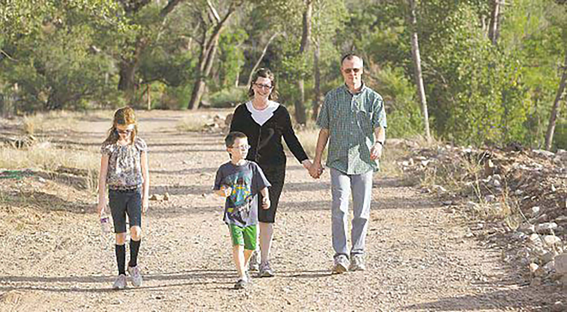
Even now, with all of the growth that has occurred in the surrounding communities in recent decades, the park has maintained its signature attribute — the quiet, Wilson said. Just a half-mile walk from one of the park’s various trail heads, and hikers no longer hear the hustle and bustle of the cities above.
“You have a feeling that you’re out in the wilderness and away from the city,” he said.
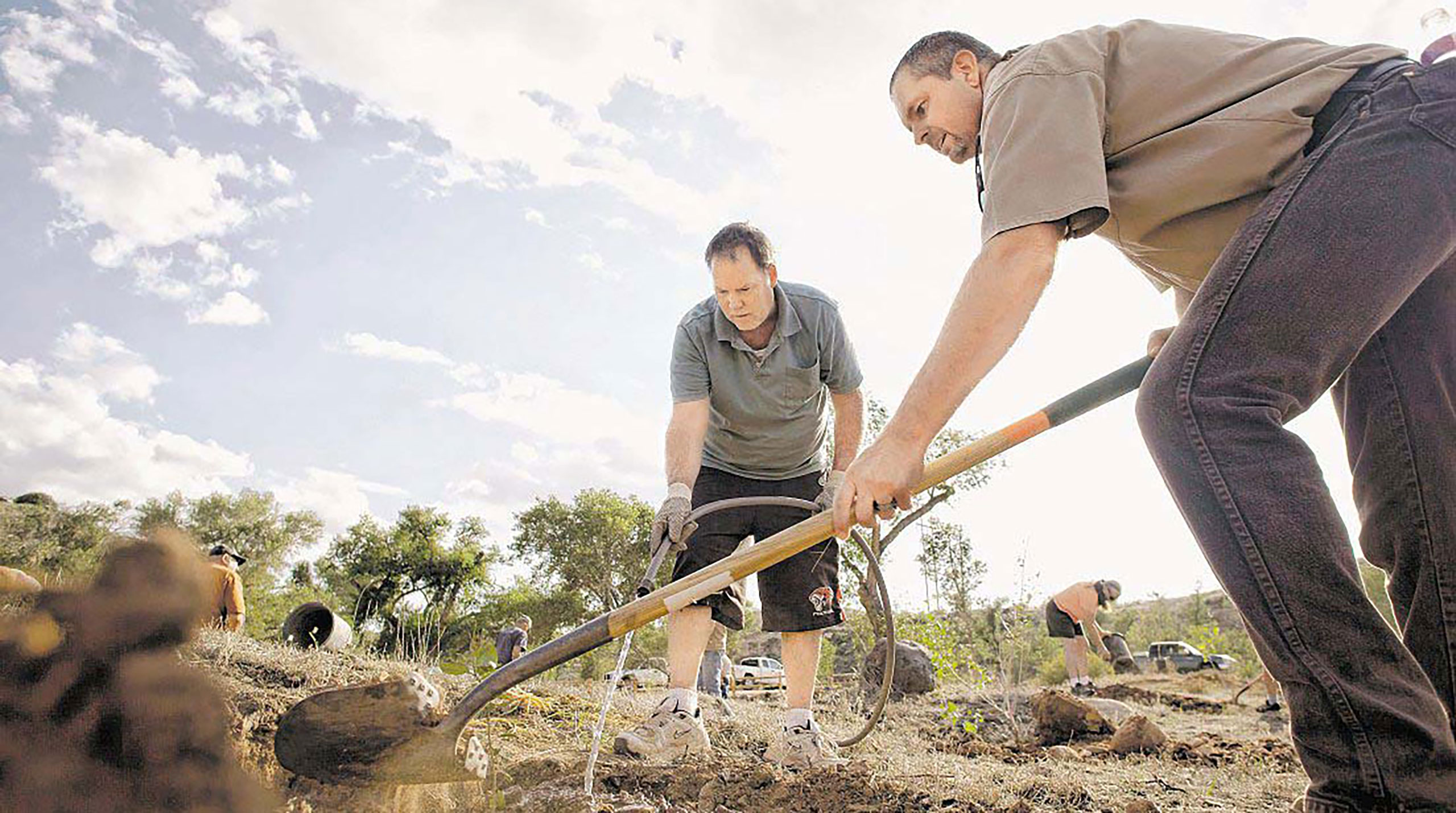
Open to hiking, biking and horseback riding, the park has been undergoing a series of projects since 2007, including restoration
work on historic buildings, rehabilitation of native plant and animal species and general cleanup. This year, officials wanted to showcase the new facilities and the work that has been done so far, said Bob Sandberg, administrator of the Habitat Conservation Plan for the neighboring Red Cliffs Desert Reserve.
There isn’t a specific budget allocated to the park, but buoyed by volunteer work from interested residents, officials have been able to utilize a number of government grants and make significant improvements. The parking lot and restroom were helped by $66,000 in federal funds, and three existing government easements created to protect endangered fish and bird species in the park help make such grants a possibility.
The hope is to continue the work into the future, with plans in place for projects like a new bridge to cross the Virgin River to improve access for hikers and bikers, but it is likely to be a long process, depending on variable funding and the commitments
of the community.
“It’s been a lot of work to get to this point, and we have a long way to go,” Sandberg said.
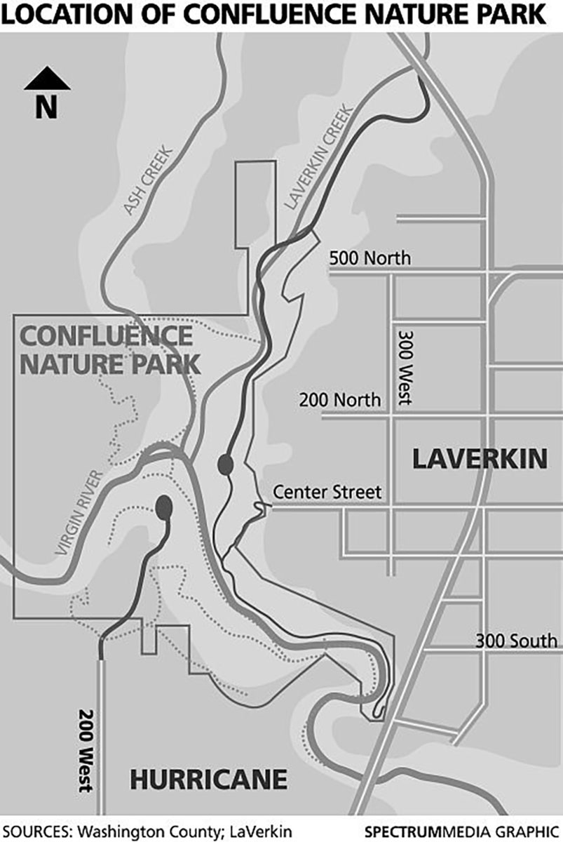
How to Get There
To get to the LaVerkin Creek Trailhead, from Highway 17 between LaVerkin and Toquerville, turn west on 900 North into the Riverwood subdivision and follow the signs to the trailhead.
In addition to the LaVerkin Creek Trailhead, there is access to the park from various points in the surrounding municipalities, including a trail near the state Route 9 bridge between Hurricane and LaVerkin and sites in Hurricane at the far north ends of 200 West and Main Street.
By David DeMille (ddemille@thespectrum.com)
Article Reposted from The Spectrum
This article is archived and no longer found on thespectrum.com website.